


Bluegrass Area Development District (Northeast) PUMA, Kentucky
About
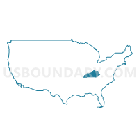
Outline
+PUMA%2c+Kentucky_A280.png)
Summary
| Unique Area Identifier | 192983 |
| Name | Bluegrass Area Development District (Northeast) PUMA |
| State | Kentucky |
| Area (square miles) | 1,338.88 |
| Land Area (square miles) | 1,325.48 |
| Water Area (square miles) | 13.39 |
| % of Land Area | 99.00 |
| % of Water Area | 1.00 |
| Latitude of the Internal Point | 38.25563710 |
| Longtitude of the Internal Point | -84.28137510 |
Maps
+PUMA in Kentucky.png)
Graphs
Select a template below for downloading or customizing gragh for Bluegrass Area Development District (Northeast) PUMA, Kentucky
+PUMA%2c+Kentucky_T0.png)
+PUMA%2c+Kentucky_T1.png)
+PUMA%2c+Kentucky_T2.png)
+PUMA%2c+Kentucky_T3.png)
+PUMA%2c+Kentucky_T4.png)
+PUMA%2c+Kentucky_T5.png)
+PUMA%2c+Kentucky_T6.png)
+PUMA%2c+Kentucky_T7.png)
+PUMA%2c+Kentucky.png)
Neighbors
Neighoring Public Use Microdata Area (by Name) Neighboring Public Use Microdata Area on the Map
- Bluegrass Area Development District (Central)--Lexington-Fayette County (Outer) PUMA, KY
- Bluegrass Area Development District (Southeast) PUMA, KY
- Bluegrass Area Development District (West) PUMA, KY
- Buffalo Trace & Gateway Area Development Districts PUMA, KY
- Northern Kentucky Area Development District (Southeast) PUMA, KY
Top 10 Neighboring County (by Population) Neighboring County on the Map
- Fayette County, KY (295,803)
- Madison County, KY (82,916)
- Franklin County, KY (49,285)
- Scott County, KY (47,173)
- Clark County, KY (35,613)
- Montgomery County, KY (26,499)
- Woodford County, KY (24,939)
- Grant County, KY (24,662)
- Bourbon County, KY (19,985)
- Harrison County, KY (18,846)
Top 10 Neighboring County Subdivision (by Population) Neighboring County Subdivision on the Map
- Lexington-Fayette Southeast CCD, Fayette County, KY (69,590)
- Frankfort CCD, Franklin County, KY (46,507)
- Lexington-Fayette Northeast CCD, Fayette County, KY (45,647)
- Lexington-Fayette Southwest CCD, Fayette County, KY (40,943)
- Georgetown CCD, Scott County, KY (38,069)
- Winchester CCD, Clark County, KY (29,984)
- Lexington-Fayette Northwest CCD, Fayette County, KY (28,862)
- Mount Sterling CCD, Montgomery County, KY (18,780)
- Paris CCD, Bourbon County, KY (15,476)
- Cynthiana CCD, Harrison County, KY (13,456)
Top 10 Neighboring Place (by Population) Neighboring Place on the Map
- Lexington-Fayette urban county, KY (295,803)
- Georgetown city, KY (29,098)
- Winchester city, KY (18,368)
- Paris city, KY (8,553)
- Cynthiana city, KY (6,402)
- Carlisle city, KY (2,010)
- Millersburg city, KY (792)
- North Middletown city, KY (643)
- Stamping Ground city, KY (643)
- Sadieville city, KY (303)
Top 10 Neighboring Unified School District (by Population) Neighboring Unified School District on the Map
- Fayette County School District, KY (295,803)
- Madison County School District, KY (76,271)
- Scott County School District, KY (47,173)
- Franklin County School District, KY (44,856)
- Clark County School District, KY (35,613)
- Montgomery County School District, KY (26,499)
- Woodford County School District, KY (24,939)
- Grant County School District, KY (21,084)
- Harrison County School District, KY (18,846)
- Pendleton County School District, KY (14,877)
Top 10 Neighboring State Legislative District Lower Chamber (by Population) Neighboring State Legislative District Lower Chamber on the Map
- State House District 62, KY (58,232)
- State House District 88, KY (49,790)
- State House District 81, KY (46,960)
- State House District 36, KY (45,022)
- State House District 76, KY (44,546)
- State House District 61, KY (44,092)
- State House District 56, KY (43,948)
- State House District 74, KY (43,768)
- State House District 73, KY (43,459)
- State House District 78, KY (41,569)
Top 10 Neighboring State Legislative District Upper Chamber (by Population) Neighboring State Legislative District Upper Chamber on the Map
- State Senate District 17, KY (133,729)
- State Senate District 7, KY (128,013)
- State Senate District 34, KY (124,714)
- State Senate District 28, KY (119,669)
- State Senate District 12, KY (115,570)
- State Senate District 27, KY (110,935)
- State Senate District 18, KY (106,760)
- State Senate District 21, KY (105,934)
- State Senate District 24, KY (105,213)
Top 10 Neighboring 111th Congressional District (by Population) Neighboring 111th Congressional District on the Map
Top 10 Neighboring Census Tract (by Population) Neighboring Census Tract on the Map
- Census Tract 101.02, Madison County, KY (6,858)
- Census Tract 110, Madison County, KY (6,219)
- Census Tract 9702, Powell County, KY (6,160)
- Census Tract 9202, Estill County, KY (6,124)
- Census Tract 302, Bourbon County, KY (6,018)
- Census Tract 9203.02, Montgomery County, KY (5,767)
- Census Tract 9503, Harrison County, KY (5,604)
- Census Tract 201.01, Clark County, KY (5,391)
- Census Tract 406.03, Scott County, KY (5,375)
- Census Tract 9303, Pendleton County, KY (5,073)
Top 10 Neighboring 5-Digit ZIP Code Tabulation Area (by Population) Neighboring 5-Digit ZIP Code Tabulation Area on the Map
- 40475, KY (55,803)
- 40601, KY (49,566)
- 40324, KY (41,342)
- 40391, KY (35,262)
- 40515, KY (33,595)
- 40509, KY (32,364)
- 40511, KY (31,798)
- 40383, KY (22,408)
- 40353, KY (20,779)
- 40361, KY (18,220)